
Sources for Watertown Neighbors
Public sources describe a Watertown block one record at a time. A parcel map shows lot boundaries and nearby parcels. The tax roll gives the owner and mailing details for each selected lot. MyVote answers election questions for a person or address, but it is not a block roster. Historical directories and newspapers can add older household or community context. None of these sources supplies a full, current list of everyone inside a home.
| Source | What It Shows About a Block | Access |
|---|---|---|
| Jefferson Public GIS | Parcel shapes, roads, ownership and boundary layers | Public map and ArcGIS service |
| County property roll | Owner, situs, mailing, tax and transfer details | Separate Jefferson and Dodge searches |
| Wisconsin MyVote | A personal registration match or polling information | Name or address mode; protected data omitted |
| Community directories | Public business and organization contacts | Open listings or direct inquiry |
| Historical sources | Past households, notices and address clues | Library and historical society |
The key distinction is owner versus occupant. An owner may rent the property, hold it through an entity, or receive tax mail elsewhere. A resident may never appear on the deed. Compare the situs address, which is the parcel’s physical site, with the owner’s mailing address. A match suggests owner occupancy, but it still does not name every person living there. Treat the record as a dated ownership fact.
Place the Watertown Block
Watertown lies in Jefferson and Dodge Counties. That split matters before any neighbor lookup because each county maintains its own parcel, deed, tax, and land-information tools. A Watertown postal label alone does not prove that an address is within city limits. The city’s land-use guidance offers a useful local test: a rural fire number that begins with a letter, such as W1234, is outside the city even if Watertown appears in the mailing address.
Check the City of Watertown GIS page, county parcel map, municipality, and ZIP before collecting nearby lots. This also catches annexation history. An address can remain recognizable after its custodian changes from a town or county office to the city. Keep the legal description when a modern address and an older source appear to disagree.
Boundary clue. County, municipality, and ZIP must agree before nearby parcel results can be treated as one Watertown block.
Jefferson GIS Shows Nearby Parcels
The Jefferson ownership MapServer exposes the parcel and ownership layers used for map research. Start with the target parcel, then select the lots that touch its side and rear boundaries. Continue to the lots across the road only when the goal is the immediate block. Road, parcel, PLSS, municipal, and annexation layers help explain why lots that look close on screen may have different jurisdictions.
PLSS means Public Land Survey System, the township, range, and section framework used in legal land descriptions. It is helpful when a road name changed or an address was renumbered. Jefferson’s public parcel result can then supply owner, situs, mailing, valuation, tax, district, and recorded-transfer details for each selected lot. On the Dodge side, the official county data-tools page links its property search and web map; the captured research confirms name, address, and ID searches but not every visible result field.
Map a Watertown Neighbor Block
Use a tight, repeatable radius. The map supplies geometry; the property roll supplies the dated owner record. Keeping those tasks separate prevents a label floating over the wrong parcel from becoming a false identity match. It also keeps a single block search from expanding into an unnecessary sweep of a whole neighborhood.
- Locate the address in the correct Jefferson or Dodge County viewer. Confirm its parcel boundary and municipality.
- Select each touching parcel, then the parcels directly across the road. Record parcel IDs before copying owner data.
- Open each county property result. Compare situs and mailing addresses, and note the tax year or update date.
- Use transfer links only to explain ownership changes. Request the full deed from the Register of Deeds when needed.
This process identifies parcels and recorded owners around one point. It does not prove who sleeps at each address, and it does not justify publishing a compiled household list. When the task expands to every numbered address along a road, use the Watertown streets resource for the longer address-by-address chain.
Watertown Voter Address Limits
Wisconsin MyVote is a match tool. Name mode requires first name, last name, and birth date. Address mode uses street address, unit, city, and ZIP to return polling-place, ballot, and election information. It should not be described as a public list of every voter on the block. A non-match can result from spelling, a recent move, inactive status, or protected treatment.
Broader voter data requests go through BadgerVoters. Wisconsin makes core registration and participation fields public while restricting full birth dates, driver-license and Social Security information, voter-ID serial data, and confidential-elector addresses. Requesters must accept the system’s terms and may receive a fee estimate. The City Clerk’s election page adds Watertown ward, aldermanic-district, and polling-place context, which is useful for civic geography but not proof of household membership.
Watertown Community Directory Gaps
No current official umbrella directory for Watertown neighborhood associations or homeowners’ groups was located. That gap should remain visible. Do not invent an association based on a subdivision name, social-media group, or map label. The Watertown Chamber member directory is a verified public community layer, but it lists member businesses and public contact information, not households.
| Local source | Public clue | Important limit |
|---|---|---|
| Watertown Chamber | Member name, category, address and phone | Business contact, not resident proof |
| Watertown Public Library | Newspapers, genealogy tools and local research help | Exact local shelf years were not verified |
| Watertown Historical Society | Directory indexes, publications and local history | An index points to a source page |
| Cemetery or parish | Burial, family and community history | Current resident rosters are not public |
For a legitimate block contact, use a publicly posted organization address or ask the city or library whether a documented group exists. Private membership lists and congregation rosters should not be treated as open resident directories.
Older Watertown Neighbors
The immediate block also has a past. Watertown Historical Society directory indexes connect a person’s name to a directory year and page. The printed entry must still be checked for the actual address and occupation. Library newspaper databases can add obituaries, marriage notices, club news, and property events. Historical maps and tax records help when house numbers or street names changed.
Oak Hill Cemetery adds a distinctive community-history route. It was founded in 1850, and its current grounds were purchased or established through the 1865 relocation period. Interment ledgers can connect deceased residents and families when an old directory trail ends. St. Bernard’s Cemetery also has a parish-linked searchable route. Cemetery evidence identifies burial and family context, not current neighbors.
Pair names across directory years only after matching the address. A static index row is a locator, not a full directory entry. If the address falls near an annexed area, search both old and current municipal labels and keep the lot or legal description as the stable link.
Official Watertown Neighbor Sources
Official rolls and commercial neighbor tools should not be treated as equals. County systems identify the custodian, purpose, update context, and correction route. A commercial compilation may blend old addresses, phone data, and inferred relationships without showing when each fact changed. It can be useful as a lead, but it is not a substitute for the original public record.
| Source type | Strength | Limit |
|---|---|---|
| County parcel and tax roll | Official parcel and owner record | Ownership is not occupancy |
| MyVote and voter file | Official election purpose and rules | Not a complete household roll |
| Library and local history source | Traceable publication or archive | Often historical rather than current |
| Commercial compilation | Broad lead gathering | May be stale, merged, or inferred |
For a wrong parcel field, save the record and date, then contact the county office. For a voter issue, use MyVote or the clerk. A source with a named custodian gives the reader a way to verify and correct the information.
Read Watertown Parcel Results
Once each nearby parcel ID is saved, read the county result in the same order. Confirm the municipality and situs address first. Then note the owner name, mailing address, tax year, and any transfer reference. Jefferson’s sample result also brings together land value, improvement value, total valuation, estimated market value, school and technical-college districts, taxes, credits, payments, and balances. Those fields help distinguish two similar parcels, but they do not add household members.
The recorded-transfer table deserves care. Its examples include corrections, quitclaim deeds, warranty deeds, administrator deeds, and mortgages. A quitclaim or correction does not necessarily represent an ordinary market sale. The full recorded instrument explains the parties and legal description. For a question about ownership history, use the document reference with the Register of Deeds rather than guessing from the short transaction label.
Compare the owner’s mailing address with the situs address only as a practical clue. Matching addresses can suggest an owner receives mail at the property. Different addresses can reflect a rental, business entity, trust, seasonal use, or a simple mailing preference. The roll does not resolve which explanation applies, and the names of other occupants remain outside its scope.
Inspect the Watertown GIS Layer
The official Jefferson County property-ownership map service exposes the mapped source used to inspect nearby lots. The captured service page appears below and provides a traceable route back to county GIS data.
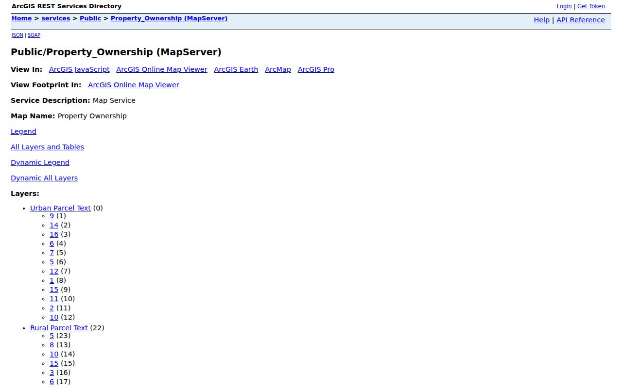
Use the live service or public viewer, not the screenshot, for a present-day search. Select the target parcel and its touching lots, save their IDs, and open the current county property entries. Map layers and records can be refreshed at different times, so note the date and ask the county land-information office about a mismatch.
Ask for Watertown Block Records
Some block information has no public search form. City Building Safety and Zoning accepts records requests for permits and code material, but the research did not locate a complete online permit index or a verified historical cutoff. Give the street address, parcel number, document type, and date range. A focused request makes it easier for staff to locate a public permit, application, inspection, or case record without asking for unrelated personal data.
Wisconsin Public Records Law, Wis. Stat. §§19.31-19.39, allows oral or written requests. The custodian must respond as soon as practicable and without delay, subject to review, lawful redaction, and statutory exceptions. Ask for the public portion, the basis for withheld material, and a fee estimate before copies are made. The Jefferson or Dodge office depends on the mapped jurisdiction.
For records that are not online, the fallback chain is the county land-information office, Register of Deeds, City Building Safety and Zoning, local clerk, library, and historical society. Each keeps a different layer. A temporary map error, closed facility, or changing login does not mean the record is absent. Save the official notice, call the published office number, and retry through the named custodian.
Watertown Neighbor Privacy Limits
A neighbor lookup cannot lawfully fill every blank. Private utility accounts, DMV addresses, delivery records, full household membership, and protected voter locations are not public substitutes for a directory. Wisconsin DOJ Safe at Home, under Wis. Stat. §165.68, gives eligible participants an assigned address. Confidential electors can also keep their actual location out of ordinary public voter records. A missing match may reflect that protection.
Property ownership is public, but publishing a stitched list of personal details creates risks that no single custodian intended. Keep only what is needed for a lawful personal purpose. Verify a concern with the responsible office, not by confronting a person based on an old or uncertain match. If a public record is wrong, identify the field and ask its custodian about correction.
Lawful use. Use Watertown neighbor records for lawful civic, family, or personal research. Never use them to watch, harass, threaten, or expose another person.